October 6, 2023
#2838: Dubious Islands explain

[Title:] Dubious Islands of North America
[Subtitle:] And the waterways that separate them
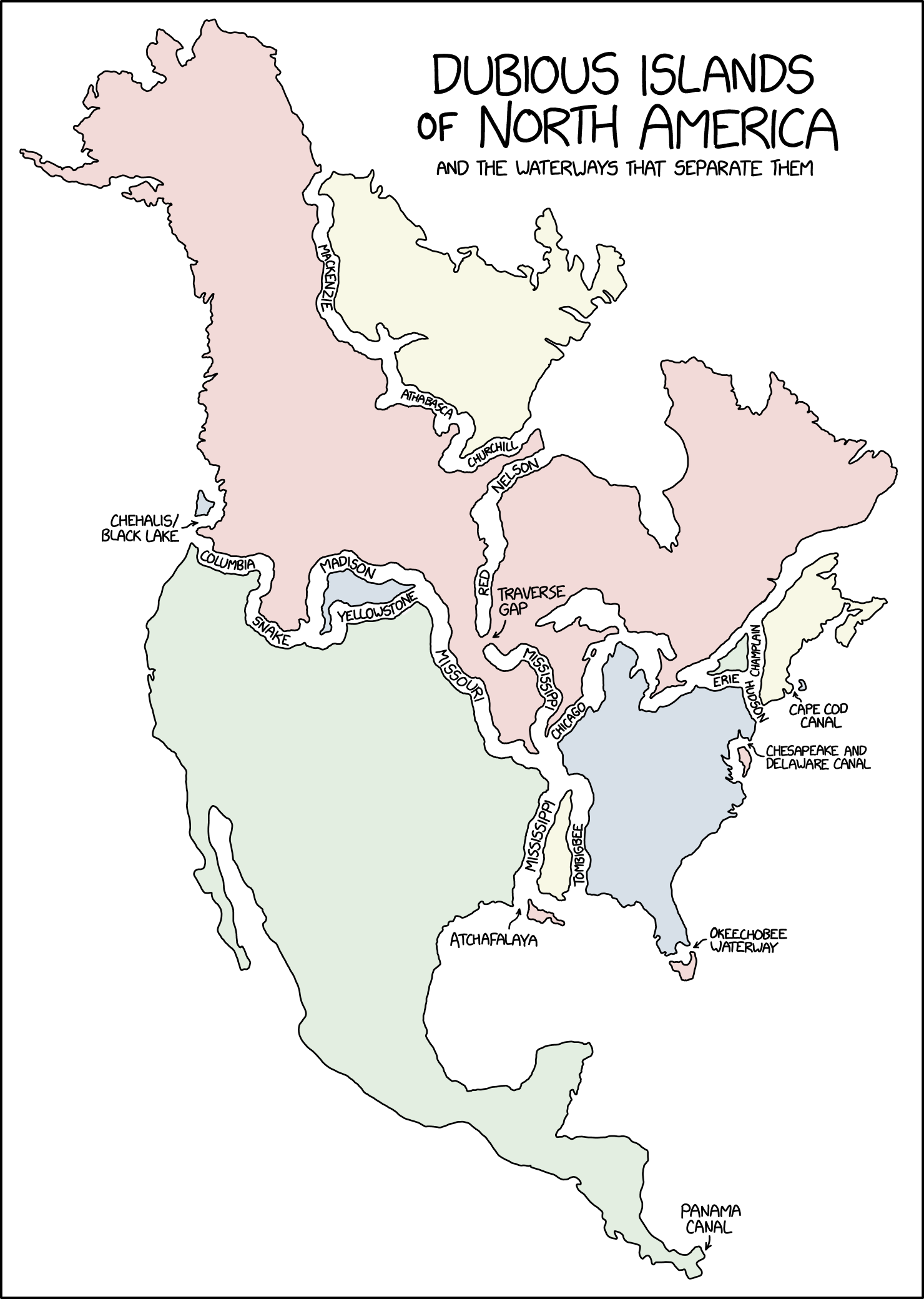
[A map of mainland North America, down to the Panama isthmus. It is internally separated by various waterways, given labels or otherwise.]
[Separating land approximating Nunavut (with some Northern Territories) from neighbouring Canada:] Mackenzie Athabasca Churchill
[Comprising the much of the remainder of Canada, much of the northern United States (including Alaska), additionally separated by:] Columbia Snake Madison Missouri Chicago [Unlabelled, some of the Great Lakes and the channel past Quebec]
[An incursive gap near the central point, from the north:] Nelson Red
[An internal label, with arrow:] Traverse Gap
[An incursive gap near the central point, from the south:] Mississippi
[A separate fragment of land south of the Madison, in the western half of the land-mass, bordered to its south by:] Yellowstone
[A small fragment off the southen part of the western edge, an arrow and a label:] Chehalis/Black Lake
[Nova Scotia, New Brunswick and parts of the adjacent US, disconnected by:] Champlain Hudson
[Label with an arrow on the east coast:] Cape Cod Canal
[A small triangle of territory, further isolated by:] Erie
[Most of the Eastern Seaboard of the US, additionally divided off by:] Tombigbee
[Fragment of land shorn from the northern part of the eastern edge, label with arrow:] Chesapeake and Delaware Canal
[Fragment of land shorn from the tip of Florida, label with arrow:] Okeechobee Waterway
[Strip of land west of the Tombigbee, bounded also to its west by:] Mississippi
[Fragment of land immediately to its south, with a nearby label and arrow:] Atchafalaya
[The remainder of the continent; comprising much of the US, all of Mexico and various central American territories, with a final tip of the eastwards-bending isthmus:] Panama Canal