April 29, 2022
#2613: Bad Map Projection: Madagascator explain

Bad Map Projection
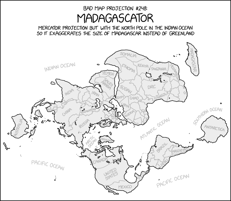
#248: Madagascator
Mercator projection but with the North Pole in the Indian Ocean so it exaggerates the size of Madagascar instead of Greenland. Various countries and oceans are labeled, and country borders are shown.
[A drawn world map in Mercator projection, with the North Pole in the Indian Ocean. The center of the map appears to be near Europe, causing regions bordering the Atlantic Ocean to appear compressed relative to those away from the it. Landmasses close to the Indian Ocean appear heavily distorted, especially the African coast, Middle East and the Indian subcontinent appearing far larger than they really are. Madagascar is now distorted and appears far larger than Greenland, which is now on the Equator, and is now comparable in size to Australia and Antarctica, both of which are on the ’equator’ of this new map.]