July 22, 2019
#2179: NWS Warnings explain

[Heading on top of frame:]
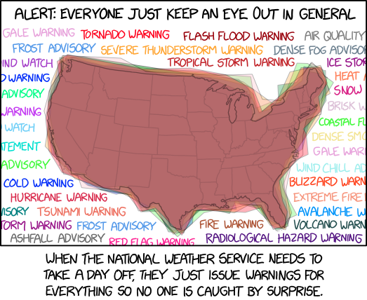
Alert: Everyone Just Keep An Eye Out In General
[A map of the 48 contiguous states of the United States, surrounded by several warning polygons that cover most or all of the area, along with parts of neighboring countries or the sea.]
[The following warning headers are printed in different colors around the map of the United States, some of which are cut off by the frame. Assumptions about text outside of the frame are given in square brackets.]
Gale Warning, Tornado Warning, Flash Flood Warning, Air Quality [Alert]
Frost Advisory, Severe Thunderstorm Warning, Dense Fog Advisory
[Hurricane Force W]ind Watch, Tropical Storm Warning, Ice Stor[m Warning]
[Extreme Cold] Warning, Heat A[dvisory]
[Flood] Advisory, Snow [Squall Warning]
[Storm Surge] Warning, Brisk W[ind Advisory]
[Lake Effect Snow] Watch, Coastal Fl[ood Advisory]
Dense Smo[ke Advisory]
[Severe Weather Sta]tement, Gale War[ning]
[Lakeshore Flood] Advisory, Wind Chill Ad[visory]
[Extreme] Cold Warning, Blizzard Warn[ing]
Hurricane Warning, Extreme Fire [Danger]
[Freezing Fog Adv]isory, Tsunami Warning, Avalanche W[arning]
[Ice S]torm Warning, Frost Advisory, Fire Warning, Volcano Warn[ing]
Ashfall Advisory, Red Flag Warning, Radiological Hazard Warning
[Text below frame:]
When the National Weather Service needs to take a day off, they just issue warnings for everything so no one is caught by surprise.