June 14, 2013
#1225: Ice Sheets explain

[Caption above the four panels:]
Thickness of the ice sheets
at various locations
21,000 years ago
compared with modern skylines.
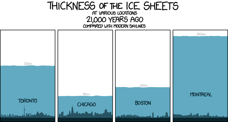
[In four panels the skylines of four major metropolises are superimposed against a blue ice sheet of the proper thickness for the aforementioned time period. The panels are much taller than the skyline reaching about 3500 meter up above ground level. Below the gray skylines there is a black slab indicating this ground level, above the ice the air is white. Also above the ice sheet the hight of the ice is noted in light gray text. Inside the ice sheet the name of the city is written in black. Some clear landmarks can be seen in each skyline.]
[The first skyline shows among other a tall TV tower. The ice reaches more than halfway to the top of the panel.]
2100m
Toronto
[The second skyline shows several skyscrapers with specially one towering over the other. The ice reaches about a quarter of the way to the top. This is the lowest of the ice sheets only reaching about twice as high as the tallest building in the city.]
900m
Chicago
[The third skyline shows only a few skyscrapers with two of them clearly taller than the rest of the skyline. The ice reaches a bit more than a third towards the top.]
1250m
Boston
[The fourth skyline do not have many real skyscrapers but there are three buildings that are taller than the rest of the skyline. The ice reaches almost to the top, making it the tallest ice sheet. The name of the city clearly is written higher up in the ice than the other three. Even above the lowest ice sheet of the second panel.]
3300m
Montreal